 High Temperature records by State
One way to gain an understanding about weather is to examine data. A spreadsheet is a powerful tool for examining data.
In the table below are the records highs for each state and territory as reported in 2006.
Here is the data in a downloadable spreadsheet.
1. This data is for temperatures through 2006. Perhaps a new record has been set since then.
Scientists work with accurate data.
Verify or update the data for your state or territory. (Double check each state that borders yours, too.)
2. Correct the appearance. Use the spreadsheet tools to make the data appear the same through out the columns.
In Temperature F° - make the alignment consistent.
Date - correct the appearance of the data in the Date column - Format - Cells - Date - Type.
3. Scientists work with data using the metric system.
Make the necessary conversions of temperature from Fahrenheit to Celsius and the elevation from feet to meters.
4. Use the spreadsheet to "test" a hypothesis. The data in the spreadsheet is sorted alphabetically by state.
Form a prediction or hypothesis. For example: you might hypothesize that there is a relationship between elevation and temperature.
Hypothesis - The lower the elevation the lower the record high will be.
To see if your hypothesis this is true, use the Sort feature in Spreadsheet.
Highlight all the data in the spreadsheet starting with the data in the elevation column.{It is important to highlight all the data so it all sorts while keeping the data in the rows intact (by state). If you highlight only a column or two, the data will sort in those columns. It will no longer be correctly related to its state. UGH!}
By the way - If I make a mistake I use the Undo feature to restore the original spreadsheet. Mac -
..z, or Edit .. Undo.
Go Data - Sort - Sort by - Select the data you want to test from the menu. In the hypothesis above I used elevation. I would select elevation.
Ascending means in order from least to most, alphabetical A-Z, coldest to warmest, oldest date to most recent date.
Descending means the opposite, of course.
| State | Temp F° | Temp C ° | Date |
Station | Elevation (feet above sea level) | Elevation Convert to meters |
| Alabama | 112° | Sept. 5, 1925 |
Centerville | 345 |
||
| Alaska | 100° | June 27, 1915 |
Ft. Yukon | 427 |
||
| Arizona | 128° | June 29, 1994 |
Lake Havasu | 505 |
||
| Arkansas | 120° | Aug. 10, 1936 |
Ozark | 396 |
||
| California | 134° | July 10, 1913 |
Death Valley | -282 |
||
| Colorado | 118° | July 11, 1888 |
Bennett | 5,484 |
||
| Connecticut | 106° | July 15, 1995 |
Danbury | 450 |
||
| Delaware | 110° | July 21, 1930 |
Millsboro | 20 |
||
| Florida | 109° | June 29, 1931 |
Monticello | 207 |
||
| Georgia | 112° | July 24, 1952 |
Louisville | 132 |
||
| Hawaii | 100° | April 27,1931 |
Pahala | 850 |
||
| Idaho | 118° | July 28, 1934 |
Orofino | 1,027 |
||
| Illinois | 117° | July 14, 1954 |
E. St Louis | 410 |
||
| Indiana | 116° | July 14, 1936 |
Collegeville | 672 |
||
| Iowa | 118° | July 20, 1934 |
Keokuk | 614 |
||
| Kansas | 121° | July 24, 1936 |
Alton | 1,651 |
||
| Kentucky | 114° | July 28, 1930 |
Greensburg | 581 |
||
| Louisiana | 114° | Aug. 10, 1936 |
Plain Dealing | 268 |
||
| Maine | 105° | July 10, 1911 |
N. Bridgton | 450 |
||
| Maryland | 109° | July 10, 1936 |
Cumberland | 623 |
||
| Massachusetts | 107° | Aug. 2, 1975 |
New Bedford | 120 |
||
| Michigan | 112° | July 13, 1936 |
Mio | 963 |
||
| Minnesota | 114° | July 6, 1936 |
Moorhead | 904 |
||
| Mississippi | 115° | July 29, 1930 |
Holly Springs | 600 |
||
| Missouri | 118° | July 14, 1954 |
Warsaw and Union | 705, 560 |
||
| Montana | 117° | July 5, 1937 |
Medicine Lake | 1,950 |
||
| Nebraska | 118° | July 24, 1936 |
Minden | 2,169 |
||
| Nevada | 125° | June 29, 1994 |
Laughlin | 605 |
||
| New Hampshire | 106° | July 4, 1911 |
Nashua | 125 |
||
| New Jersey | 110° | July 10, 1936 |
Runyon | 18 |
||
| New Mexico | 122° | June 27, 1994 |
Lakewood | 3540 |
||
| New York | 108° | July 22, 1926 |
Troy | 35 |
||
| North Carolina | 110° | Aug. 21, 1983 |
Fayetteville | 213 |
||
| North Dakota | 121° | July 6, 1936 |
Steele | 1,857 |
||
| Ohio | 113° | July 21, 1934 |
Gallipolis | 673 |
||
| Oklahoma | 120° | June 27, 1994 |
Tipton | 1,350 |
||
| Oregon | 119° | Aug. 10, 1898 |
Pendleton | 1,074 |
||
| Pennsylvania | 111° | July 10, 1936 |
Phoenixville | 100 |
||
| Puerto Rico | 98° | October 9, 1981 * |
San Juan | 59 |
||
| Rhode Island | 104° | Aug. 2, 1975 |
Providence | 51 |
||
| South Carolina | 111° | June 28, 1954 |
Camden | 170 |
||
| South Dakota | 120° | July 15, 2006 |
Kelly Ranch/Usta | 2,339 |
||
| Tennesse | 113° | Aug. 9, 1930 |
Perryville | 377 |
||
| Texas | 120° | Aug. 12, 1936 |
Seymour | 1,291 |
||
| U.S. Virgin Islands | 93° | Aug. 31, 1998 |
St. Croix* | 110 |
||
| Utah | 117° | July 5, 1985 |
Saint George | 2,880 |
||
| Vermont | 105° | July 4, 1911 |
Vernon | 310 |
||
| Virginia | 110° | July 15, 1954 |
Balcony Falls | 725 |
||
| Washington | 118° | Aug. 5, 1961 |
Ice Harbor Dam | 475 |
||
| West Virginia | 112° | July 10, 1936 |
Martinsburg | 435 |
||
| Wisconsin | 114° | July 13, 1936 |
Wisconsin Dells | 900 |
||
| Wyoming | 116° | Aug. 8, 1983 |
Basin | 3,500 |
Sources: U.S. National Climatic Data Center (last updated August 2006), USA Today, * Weather Underground
Lowest temperature records | North America Climate Extremes Monitoring | U.S. Climate at a Glance
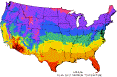
NOAA | NESDIS | Temperature map USA - annual mean daily maximum | Weather Forecasting online meteorology
Challenge yourself - Weather Scope - An investigation of weather and climate
Location Conundrum - You are to set up a thermometer to measure outside air temperature for one year.
If you place it in an open area, how might that affect your results?
If you place it under/in a deciduous tree, how might that affect your results?
How would the effect be different if you placed the thermometer under a coniferous tree?
Where should a thermometer be placed outside for accuracy in measuring air temperature?
The Pennsylvania Weather Book by Ben Gelber preview in Google Books
The Community Collaborative Rain, Hail and Snow Network (CoCoRaHS) is a weather project that’s unique. Using low-tech data collection methods instead of of high-priced weather stations, CoCoRaHS collects and shares important precipitation data.
Mapping Renewable Energy, Rooftop by Rooftop - Time, 12/22/08
Internet Hunts / Nature / Computers / Pennsylvania Projects / Puzzles & Projects / Social Studies Links / Site map / Home
posted 3/2008 by Cynthia J. O'Hora released to public domain
Tech Tip: Working on this project in two different places, like the library & home? Perhaps you are working on a group project. You do not have to be physically together to work together. You can access your work from several places. How? Free Google Docs.
![]() Watch Google Docs video TAI - How could you use free, Google Docs to do a project? How would this facilitate group projects?
Watch Google Docs video TAI - How could you use free, Google Docs to do a project? How would this facilitate group projects?